
Henning is in the middle of a great divide
News | Published on March 17, 2021 at 2:02pm EDT | Author: Chad Koenen
0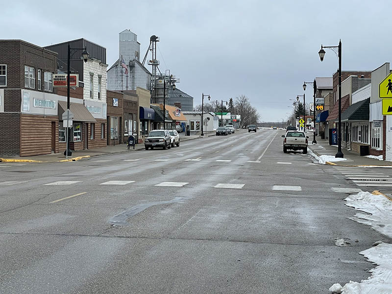
According to Gary Meyer, the Continental Divide goes right through the heart of Henning along Highway 108 in downtown Henning.
Laurentian Divide goes right through the heart of downtown Henning
By Chad Koenen
Publisher
So what really divides the city of Henning? As it turns out, more than you might think. That’s because Henning sits right on a Laurentian Divide (Continental Divide), which sends some water North and West, and other water East and South—depending upon what side of Main Street you are on.
Gary Meyer, of the Minnesota Geological Survey Department, said the Continental Divide basically goes right through downtown Henning.
“The Main Street, Highway 108, is pretty much right on the divide,” said Meyer. “The Continental Divide is right in Henning.”
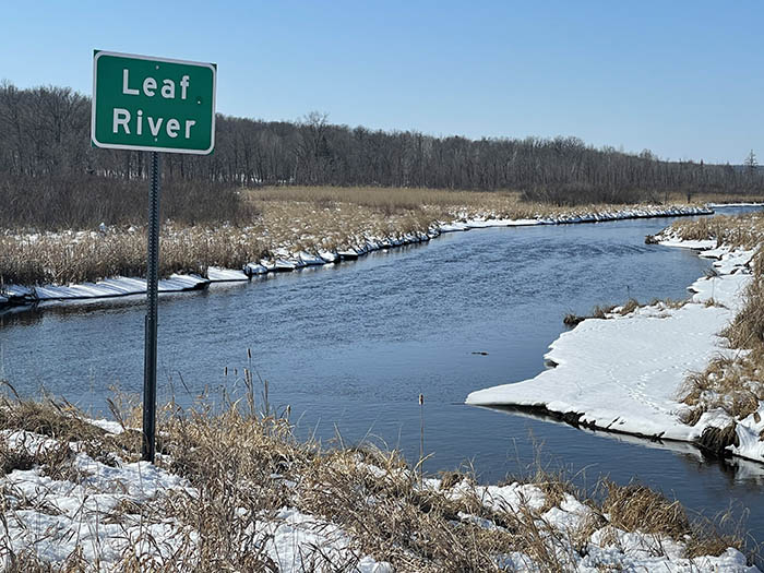
According to Meyer, most of the water on the East side of Highway 108 flows to Willow Creek. That body of water eventually joins Leaf River, flows to the Red Eye River and joins the Crow Wing River near Staples, Minn. The river is a tributary to the Mississippi, which ends up dumping water into the Gulf of Mexico.
On the other side of Highway 108, some of the water flows to Brandborg Creek and eventually into Otter Tail Lake and the Otter Tail River. That expansive and long flowing river helps to form the backbone of the Red River of the North. That river flows North into Canada and the Hudson Bay.
According to Meyer, the Continental Divide follows a path from Fergus Falls to Henning and then to New York Mills. Unlike some areas along the Continental Divide, Meyer said Henning’s divide isn’t as defined and follows a pretty low line along portions of Highway 108.
The town’s location along the Continental Divide was created, in large part, due to the glaciers that formed the land thousands of years ago.
“Henning is actually built on this sand plane (created by the glaciers). Part of the reason why you are on the Continental Divide, at least in Henning, is because of where the glaciers stopped.”
Gary Meyer
Meyer said Henning is pretty unique in the way the soil and land was created due to its proximity to a pair of glaciers. The first of the two major glaciers in the area was called the Wadena Lobe, which created narrow and canoe shaped ridges that are commonly seen north of Bluffton. That land is essentially where the land goes up and down. The Wadena Lobe formed the land from the North, East and South of Henning. That glacier was more ground up granite and hard stone.
The last glacier in Otter Tail County stopped just to the West of Henning and was called the Des Moines Lobe. That glacier makes up much of the sandy and clay soil that is located West of town, which ended up melting just outside of the city limits.
“If you could transport Henning back in time, if you looked out your window to the West, you would have seen a wall of ice,” said Meyer.
Ironically, Meyer is working on a geological atlas of Otter Tail County, which has some unique characteristics from when the glaciers melted in the area. He is trying to put all of that information together in a book that will show how the soils and area was formed thousands of years ago.
“We try to map various aspects of the geology,” said Meyer.
But back to the previous question at hand about dividing the town of Henning.
If you are looking for a fun experiment this weekend, pour out a bottle of water in B&D Foods parking lot. There is a chance that water could one day end up in the Gulf of Mexico. Walk across the street and pour out another bottle of water at Gateway Pub and there is a chance that water could end up in the Hudson Bay.